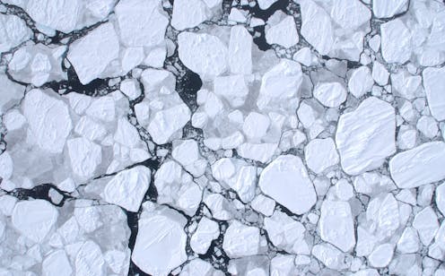
 Jan Lieser, CC BY-SA
After two seasons of record-breaking lows, Antarctica’s sea ice remains in dramatic decline, tracking well below any winter maximum levels observed since satellite monitoring began during the late 1970s.
A layer of frozen seawater that surrounds the Antarctic continent, sea ice cycles from maximum coverage in September to a minimum in February. The summer minimum has also continued to diminish, with three record low summers in the past seven years.
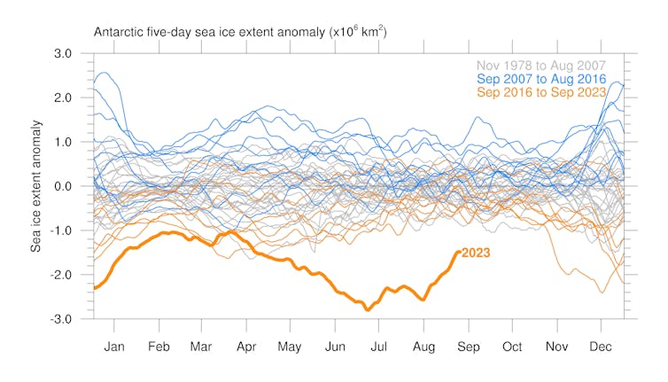 Antarctic sea ice has been in sharp decline in recent years and its winter maximum reached a record low this year.
Ariaan Purich, CC BY-SA
Some scientists have suggested this year could mark a regime shift for Antarctic sea ice. The consequences could be far-reaching for Earth’s climate, because sea ice keeps the planet cooler by reflecting solar energy back into the atmosphere and insulating the ocean. Its formation also generates cold, salty water masses that drive global ocean currents.
The annual freeze-thaw cycle of Antarctic sea ice is one of Earth’s largest seasonal changes, but is a major challenge for climate models to predict accurately.
Since the 1970s, satellites have been tracking a quantity known as “sea ice extent”, which is the total surface area where at least 15% is covered by sea ice.
This September, it reached a satellite-era record low for this time of year. The previous year, after tracking much lower than the median all winter, Antarctic sea ice extent made a late rally and was 18.3 million square kilometres at its maximum by September 2022, around 2% below the 1981-2010 median.
Although 2% might not sound like much, the following summer biologists reported devastating effects on Emperor penguins. No chicks survived in four out of five breeding sites in one region of sea ice loss.
In 2023, Antarctic sea ice extent started the winter even lower than in 2022, and by the end of July was almost 13% below the 1981-2010 median for that time of year. It reached its maximum extent on September 7, at just under 17 million square kilometres, which is nearly 9% below the 1981-2010 median.
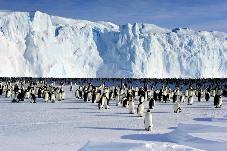 Emperor penguins need sea ice to breed. In four out of five breeding sites in one region of sea ice loss, no chicks survived.
Pat James/Australian Antarctic Division, CC BY-SA
Why we couldn’t predict this
Antarctica has bucked the trend of vanishing sea ice observed in the Arctic for decades. Satellite records show a small increasing trend in Antarctic sea ice extent from 2007 to 2016, but this was followed by a decrease since then.
A recent study shows that almost all models in the current collection of simulations used for the latest report by the Intergovernmental Panel on Climate Change (IPCC) failed to reproduce the trend in Antarctic sea ice area observed between 1979 and 2018.
Global climate models predicted that Antarctic sea ice extent should have been diminishing for all of that period, which is at odds with the observations.
Read more: Devastatingly low Antarctic sea ice may be the ‘new abnormal', study warns
These models remain our best tools for forecasting future climate. They have been developed since the 1960s to represent the wide range of physical processes of importance to the climate system as realistically as possible.
They are made up of individual component models for the circulation of the atmosphere and oceans, the transfer of solar energy through the atmosphere, land surface properties and the evolution of sea ice.
While these models have generally done well at forecasting ocean and land surface warming over the past few decades, they have struggled to simulate Antarctic sea ice.
Many research groups around the world have investigated the reasons why models have failed to accurately simulate Antarctic sea ice. Changes in wind and wave patterns, natural variability, stratospheric ozone and melt water from the Antarctic ice sheet entering the Southern Ocean have all been proposed as potential explanations.
So far, none of these have proved to be the definitive answer.
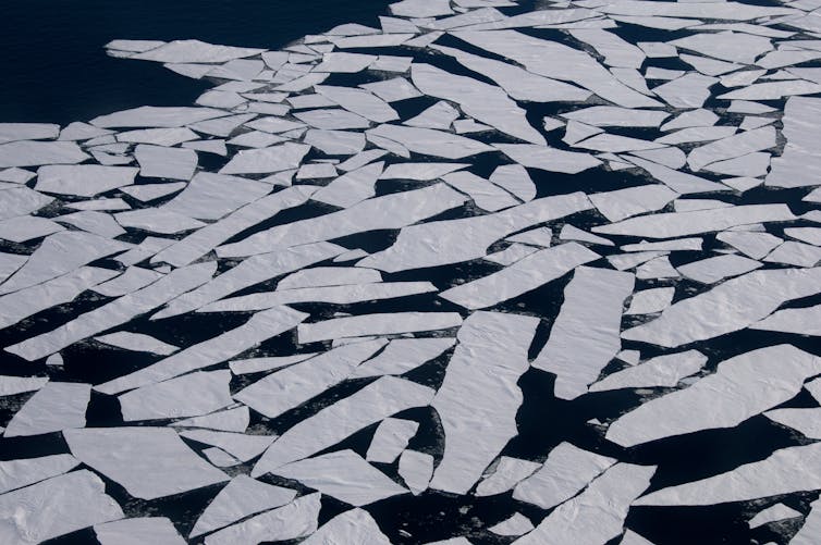 At the time of its September maximum, Antarctic sea ice extent was nearly 9% below the 1981-2010 median for that time of year.
Glenn Jacobson/ Australian Antarctic Division, CC BY-SA
Changes in sea ice thickness
The thickness, or depth, of sea ice cannot be measured directly by satellites because it is thin, salty and hidden below a layer of snow of unknown thickness.
Unlike the Arctic, where we have extensive data from submarines and other sources, information about Antarctic sea ice thickness is very sparse. The data we have mainly come from holes drilled in the sea ice, sea ice monitoring stations, and electromagnetic induction measurements from sleds, helicopters or planes.
The data are mostly from land-fast sea ice, which is the sea ice attached to land or ice shelves.
Read more: Fractured foundations: how Antarctica's 'landfast' ice is dwindling and why that's bad news
We have only a few airborne thickness measurements over freely moving pack ice, which makes up most of Antarctic sea ice. We need both sea ice area and thickness to determine sea ice volume, which is important for knowing the overall impact of climate change on sea ice.
Antarctic storms
McMurdo Sound is a region of the Antarctic coastline in the Ross Sea where both New Zealand (Scott Base) and the USA (McMurdo Station) have Antarctic bases. The sea ice in McMurdo Sound was dramatically thinner than usual in 2022, but not in 2023.
In 2022, multiple storms kept blowing out McMurdo Sound sea ice during winter. Sea ice that would normally be about two metres thick was around 1-1.3 m thick because it was not able to stay in place and grow thicker over the winter season.
Snow was thicker than usual in places, which slowed down the growth of sea ice by insulating it from the cold air above. The weather was not warmer, and the ice had not melted; it had been blown out by strong winds.
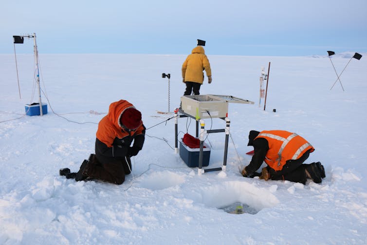 Scott Base staff had to carry monitoring equipment onto the sea ice on foot due to vehicle access issues.
Catherine Kircher (Antarctica New Zealand), CC BY-SA
This thinner-than-usual sea ice caused major disruptions in Antarctic operations for New Zealand and other countries in 2022. The University of Otago’s automated sea ice monitoring system is installed each year to measure sea ice thickness, temperature and snow depth. In 2022, Scott Base staff had to take the equipment onto the sea ice on foot for the first time because the sea ice was deemed unsafe to drive vehicles on.
Seeing open water in front of McMurdo Station in the middle of winter in 2022 was shocking for us. However, despite the extremely low winter sea ice extent around most of Antarctica in 2023, sea ice in McMurdo Sound formed in a similar way to most years.
It is not yet clear how much climate change has driven the huge anomalies in Antarctic sea ice extent or thickness, but events like these could be a harbinger of things to come.
To have a chance of predicting these changes, we will need dramatically improved modelling capabilities, more measurements of crucial factors driving sea ice change, and new ways of making those measurements.
We have received research funding from the Deep South National Science Challenge, the Antarctic Science Platform and the Marsden Fund. We received logistical support for Antarctic field work from Antarctica New Zealand, and high performance computing resources through NeSI.
Pat Langhorne has worked on sea ice for 35 years, receiving research funding from the Deep South National Science Challenge and the Marsden Fund, among others. Logistical support for Antarctic field work has been provided by Antarctica New Zealand and the Australian Antarctic Division.

 1 year ago
65


